Walking & Cycling
Local Walking and Cycling Routes
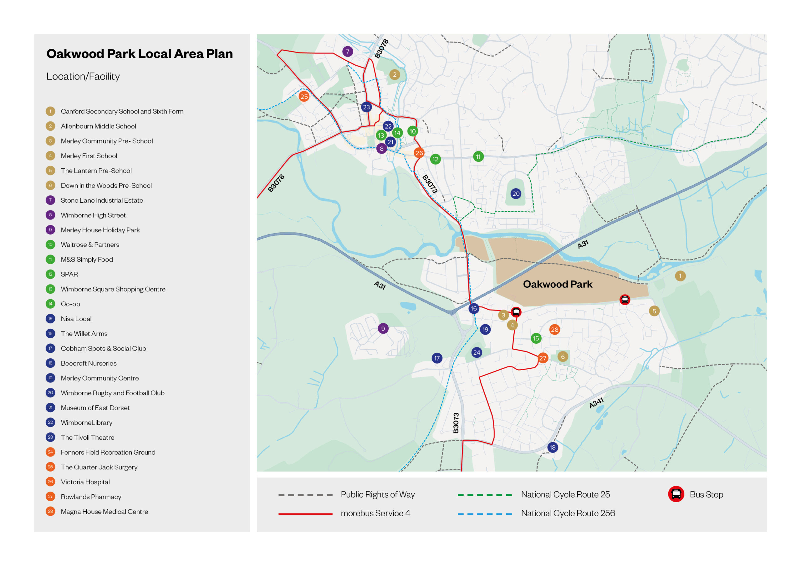
Oakwood Park is surrounded by numerous walking and cycling routes offering sustainable access to Wimborne town centre and other nearby amenities. Take a look at your local cycle routes and footpaths below:
To the south of Oakley Lane, a segregated footway / cycleway is provided on the eastern side of Oakley Hill and links with the Castleman Trailway which is an offroad route which follows much of the old railway line and forms part of National Cycle Route 25.
Public Footpath 92 enables residents to walk along the River Stour from east to west of the site. This footpath continues under the A3 before joining to the footway along Oakley Hill in the west providing residents with an onwards walk into Wimborne town centre.
For other information and to find alternative walking routes in the area and beyond please visit:
National Cycle Network
The National Cycle Network provides huge benefits to health and wellbeing, with 4.4 million people using the network between 2017 and 2018. 786 million walking and cycling trips were made on the Network. As a result, £88 million was saved through reduced road congestion.
National Cycle Route 25 runs through Oakley Hill which provides a direct cycle route into the centre of Wimborne. This route also connects to Route 24 at Longleat and to the south through Gillingham and Poole to Bournemouth. Cyclists are able to enjoy a large stretch of this route offroad, through much of the old railway line. Furthermore, Route 25 also provides an opportunity to cycle on route 256 to Ringwood.
For more information on the National Cycle Network visit the SUSTRANS website. You can also view the National Cycle Network map here as well as getting in touch for more information.


