Walking & Cycling
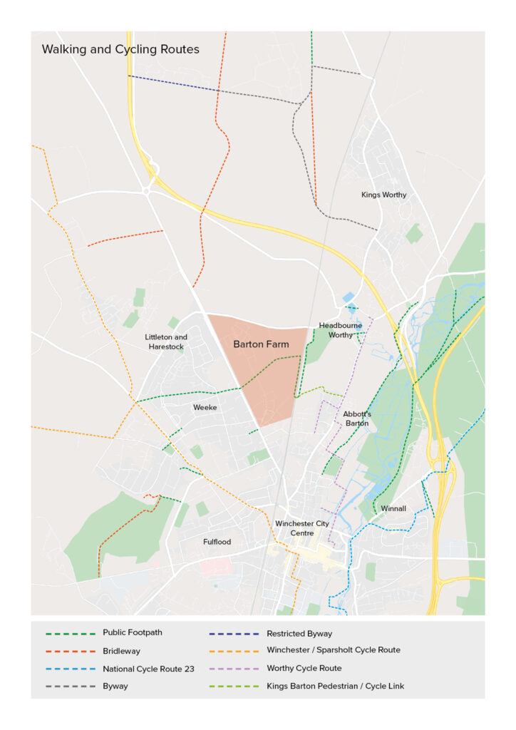
Local Walking and Cycling Routes
Kings Barton is surrounded by a number of walking and cycling routes providing access to destinations in Winchester and Hampshire. Take a look at your local walking and cycling routes below:
For more further information on local Winchester and Sparsholt cycling routes visit:
For other information and to find alternative walking routes in the area visit:
Ramblers Association – www.ramblers.org.uk
FootPath Map – www.footpathmap.co.uk
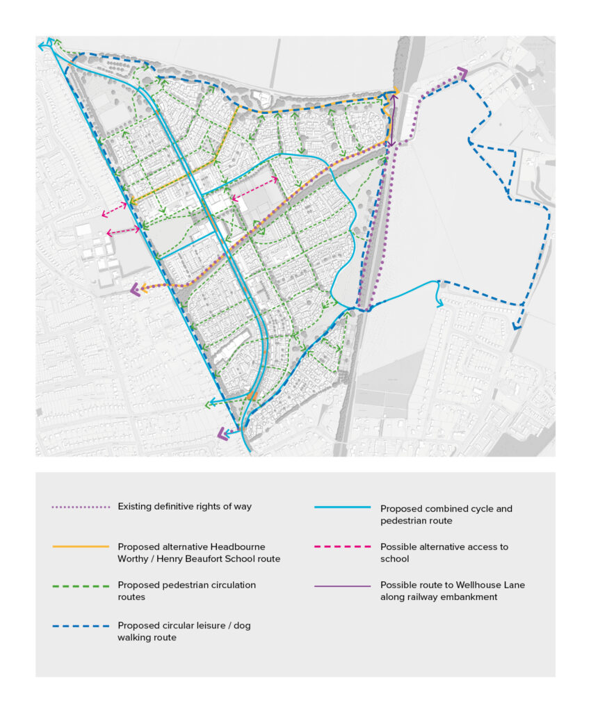
On-Site Connections
Through your development there are a number of pedestrian and cycle connections which provide access to different parts of Kings Barton including the primary school and the future local centre. View the onsite connections here:
National Cycle Network
The National Cycle Network provides huge benefits to health and wellbeing, with 4.4 million people using the network between 2017 and 2018. 786 million walking and cycling trips were made on the Network. As a result, £88 million was saved through reduced road congestion.
For more information on the National Cycle Network visit the SUSTRANS website:


